|
Night time, Dry
|

|
63.6°F

---
Feels like:
64°F
24-hr difference
25.3°F |
| |
Today |
Yesterday |
| High: |
63.7°F
12:12am |
79.9°F
4:03am |
| Low: |
62.9°F
12:00am |
38.2°F
12:17am |
|
Webcam: Newton Falls, OH

|


|
S
0
Gust:
0 mph
|
|
0 Bft -
Calm
|
|
Gust Today:
6.3 mph
12:06am
|
|
Gust Month: 26.7 mph
4/2/2026
|
|
Gust Year: 63.3 mph
3/13/2026
|
| Wind Chill/Heat Index |
|
Min WC Today:
62.9°F
12:00am
|
|
Min WC Month: 33.3°F
4/1/2026
|
|
Min WC Year: -21.5°F
1/27/2026
|
|
Max HI Today:
63.7°F
12:12am
|
|
Max HI Month: 79.9°F
4/2/2026
|
|
Max HI Year: 79.9°F
4/2/2026
|
|
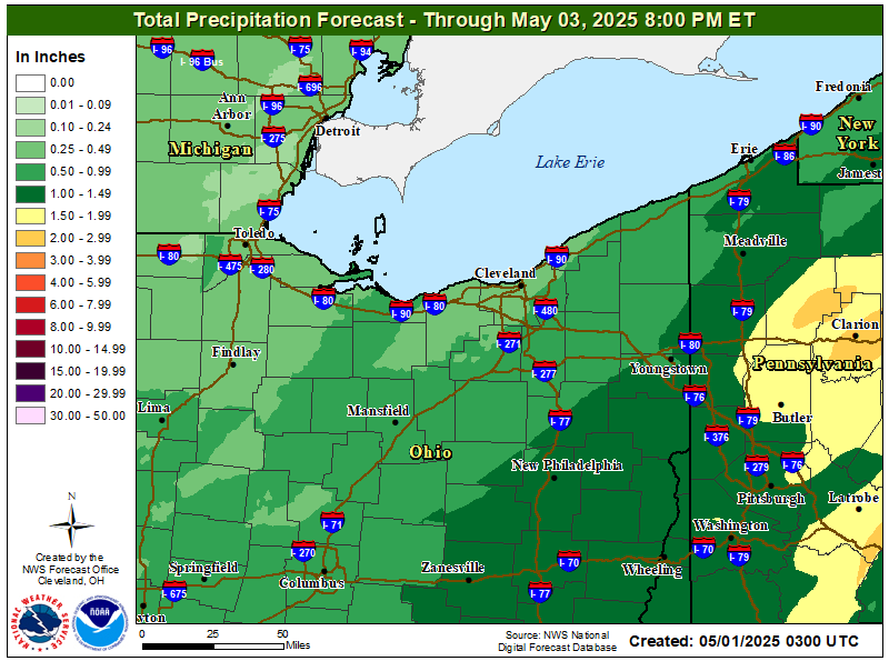
| Rain Today: |
0 in
|
| Rain Rate (/hr): |
0 in
|
| Rain Yesterday: |
0.05 in
|
| Storm Rain: |
2.4 in |
| This Month: |
1.09 in
|
| Year to Date: |
9.33 in
|
|
2 rain days in April. |
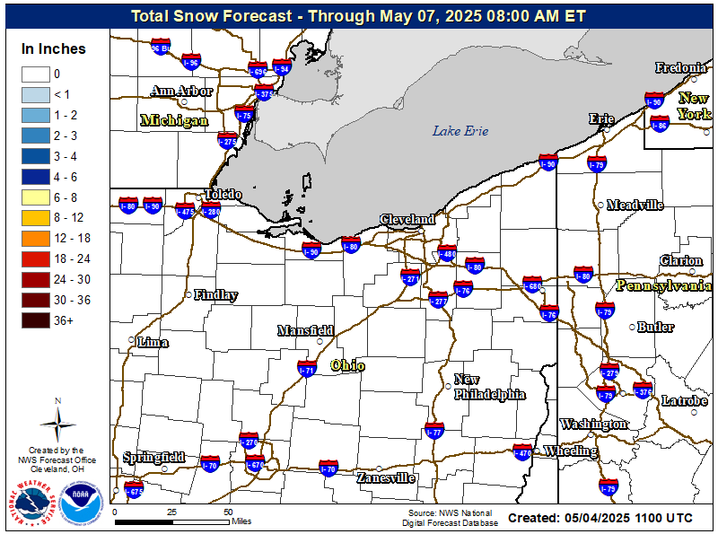
| Snow |
| Snow Today: |
0 in |
| Snow Yesterday: |
0 in |
| This Month: |
0 in |
| Seasonal Total: |
62.3 in |
| Snow Depth: |
0.1 in |
|
0 snow days in April. |
|
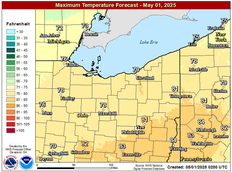
Tonight

Slight Chance Showers And T-Storms then Chance Showers And T-Storms
|
|
Lo 63 °F |
|
Friday

Showers And T-Storms Likely
|
|
Hi 77 °F |
|